Transform Ninja Forms with Smart Geolocation Features
Collect locations, validate addresses, calculate routes, find nearby locations, and build powerful location-aware workflows inside Ninja Forms.
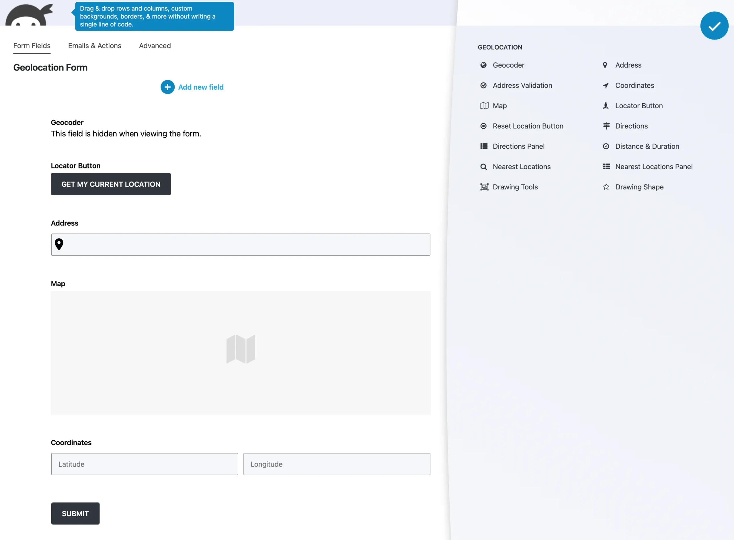
Unlock Powerful Geolocation Capabilities for Ninja Forms
Capture, display, and process location data effortlessly with advanced geolocation tools. Enhance your forms with real-time location tracking, interactive maps, and address autocompletion to streamline user input.
Native Ninja Forms Integration
Build location-aware forms using native Ninja Forms fields and workflows.
Complete Geolocation Fields
Capture addresses, coordinates, maps, directions, and user locations.
Interactive Maps
Display and interact with locations directly inside your forms.
Address Validation
Verify, standardize, and improve address quality before submission.
Routes & Distance Calculation
Calculate travel routes, distance, duration, and pricing automatically.
Nearest Locations
Find the closest store, office, service area, or pickup location.
Drawing Tools & Service Areas
Create delivery zones, territories, and custom map boundaries.
Location-Based Workflows
Use geolocation data with calculations, conditional logic, and automation.
Interactive Maps & Entries
Display single or multiple form submissions on interactive Google Maps.
Dynamic Location Sync
Keep addresses, maps, coordinates, and location fields synchronized.
Flexible Geolocation Data
Store and reuse location data across forms, entries, and custom workflows.
Google Maps Platform Powered
Built on Google Maps Platform for accurate geocoding, routing, and mapping.
Performance Optimized
Fast, lightweight architecture designed for modern Ninja Forms sites.
Developer Friendly
Extensive hooks, filters, and customization options for developers.
Mobile Ready
Responsive geolocation fields and maps that work across desktop and mobile devices.
Geocoder Field
Automatically geocode addresses, reverse geocode coordinates, and synchronize location data throughout your Ninja Forms.
Optimized Location Synchronization
Ensure Address, Map, and Coordinates fields remain in sync, automatically updating when users modify location details for consistent and accurate data.
Multi-Location Flexibility
Easily add single or multiple geolocation field sets, allowing users to enter and manage multiple locations dynamically within a single form.
Comprehensive Geodata Retrieval
Capture detailed geolocation insights, including street addresses, latitude, longitude, and additional metadata for enhanced location-based functionality.
Smart Field Autofill
Easily convert addresses into precise coordinates and vice versa, enabling smooth, automated geolocation data handling in Ninja Forms.
Address Field
Collect accurate addresses with Google-powered autocomplete, geocoding, and current location detection.
Precision Address Geocoding
Instantly convert user-provided addresses into structured geolocation data, enabling accurate tracking and seamless mapping.
Real-Time Autocomplete Suggestions
Boost user efficiency with Google Places-powered autocomplete, offering dynamic address recommendations as users type.
One-Click Location Detection
Allow users to auto-fill their address fields with a single tap using the built-in Auto Location Button, eliminating manual entry.
Adaptive Location Data Handling
Automatically populate hidden or visible fields with geocoded data, ensuring a consistent and reliable flow of location details in your forms.
Coordinates Field
Capture precise latitude and longitude coordinates for accurate geolocation data.
Manual Coordinates Input
Let users enter latitude and longitude manually for pinpoint accuracy.
Automated Geolocation Conversion
Instantly transform coordinates into structured address data for seamless form processing.
Automatic Geolocation Sync
Ensure seamless integration across all geolocation fields—whenever coordinates are updated, the address field and map marker adjust dynamically to maintain accurate and consistent location data.
Map Field
Allow users to pinpoint locations using a fully interactive Google Map inside Ninja Forms.
Drag & Drop Marker Placement
Enable users to click or drag markers on the map for pinpoint accuracy, allowing effortless manual location selection.
Multiple Marker Support
Choose between single or multiple markers to accommodate different geolocation needs, from simple address selection to multi-point mapping.
Fully Customizable Map Controls
Adjust zoom levels, default coordinates, map styles, and marker icons to match your form’s design and user experience preferences.
Directions & Routing Field.
Calculate routes, travel distance, and estimated travel time directly inside Ninja Forms.
Built-in Routing & Directions
Easily generate and display routes between multiple locations, making navigation simple for users.
Interactive Map Guidance
Display intuitive visual routes to help users understand their travel path.
Step-by-Step Navigation
Provide detailed driving, walking, or biking directions with precision.
Automatic Distance & Time Estimation
Instantly calculate distance and estimated travel duration for better planning.
Customizable Distance-Based Pricing
Set up variable pricing models based on travel distance, ideal for services like delivery and logistics.
Distance & Duration Field
Calculate travel distance and estimated duration between two locations without displaying full routes.
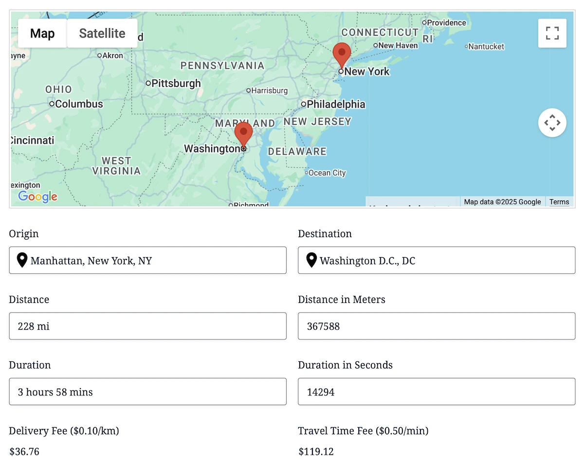
Built for pricing and calculations
Use travel distance and duration inside pricing, quotes, eligibility rules, and automation.
Google Routes API or Straight-Line
Choose between real road routing or fast straight-line distance calculations.
Dynamic Field Population
Automatically populate Ninja Forms fields with calculated distance and duration values.
Works with Multiple Inputs
Supports Address, Coordinates, Map, and other geolocation fields.
Drawing Tools & Shape Fields
Create service areas, delivery zones, territories, and custom map regions directly inside Ninja Forms.

Multiple Shape Types
Draw polygons, rectangles, circles, polylines, markers, and freehand shapes.
Live Measurements
Calculate area, perimeter, length, radius, and center points automatically.
Shape Management
Import, export, edit, duplicate, label, recolor, and manage shapes.
GeoJSON Support
Save, preload, and export shapes as GeoJSON.
Address Validation
Verify, standardize, and improve address quality before submissions reach your workflow.
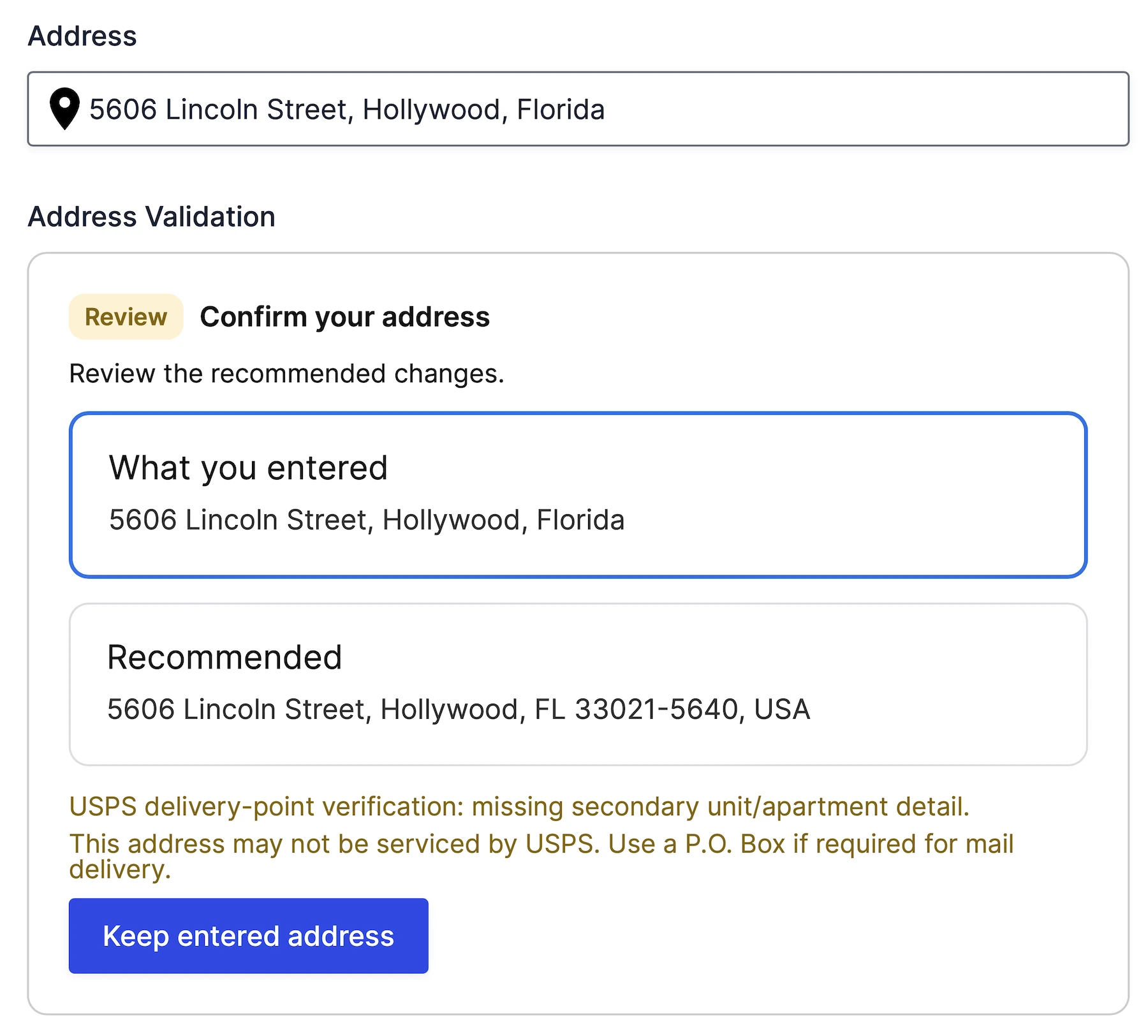
Verify Address Accuracy
Validate addresses using Google’s Address Validation API.
Suggested Address Corrections
Allow users to review and accept Google’s recommended address.
USPS Delivery Verification
Detect missing apartment, suite, and secondary unit information.
Workflow Ready
Expose validation status, delivery status, and standardized addresses for automation.
Nearest Locations
Find the closest predefined locations using driving distance, travel time, or radius calculations.
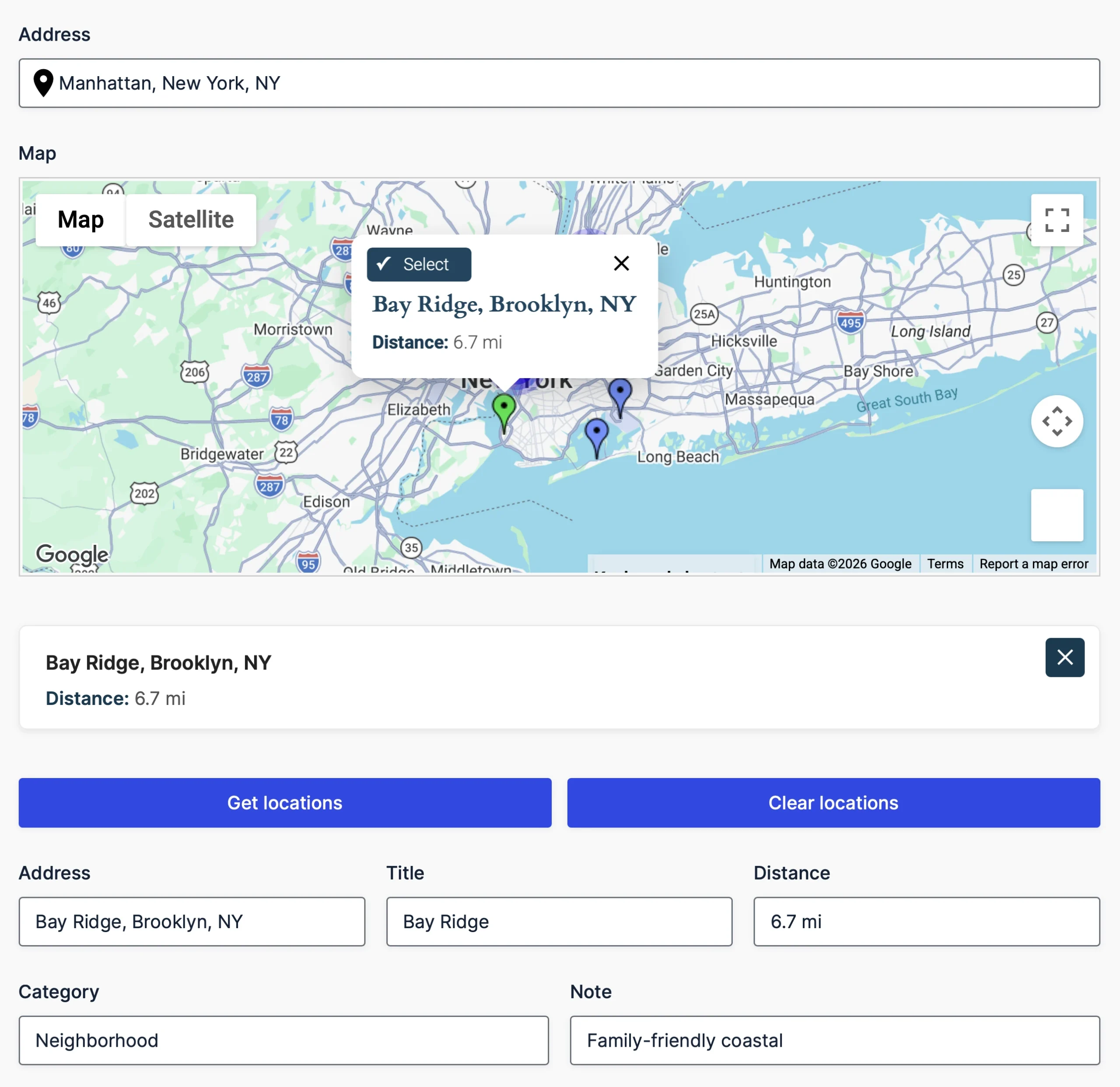
Find the Nearest Location
Automatically identify the closest store, office, pickup point, or service area.
Driving Distance & Travel Time
Compare locations using real-world routing.
Flexible Location Sources
Load locations from manual lists, CSV/JSON files, or database tables.
Dynamic Field Population
Populate Ninja Forms fields with the selected nearest location.
Single Entry Map
Display one submitted location on its own interactive Google Map.
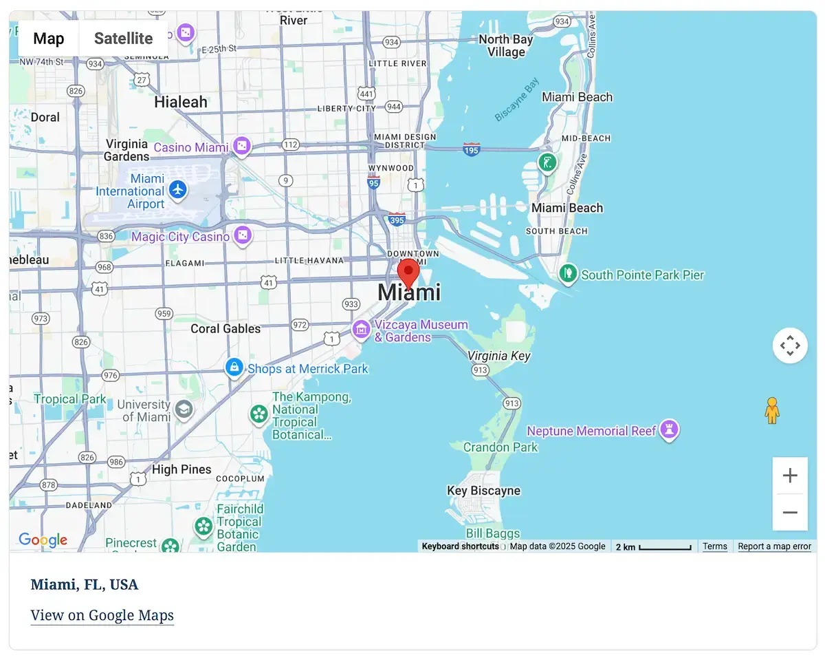
Entry-Focused Maps
Display only the selected Ninja Forms submission.
Rich Location Information
Show address, coordinates, and geolocation details.
Fully Customizable Display
Control zoom, marker, map type, styles, and dimensions.
Easy Embedding
Place maps anywhere using a shortcode.
Mashup Map
Showcase multiple locations on a dynamic map, perfect for visualizing Ninja Forms submissions and locations.
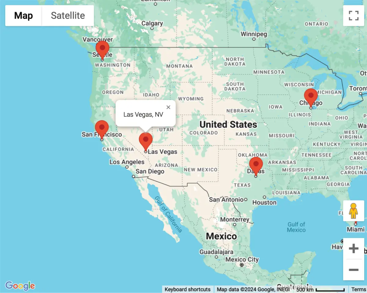
Real-Time Location Visualization
Aggregate and display user-submitted locations on a single, interactive map.
Live Data Updates
Instantly refresh geolocation data from form submissions for accurate mapping.
Easy Embedding with Shortcodes
Add maps anywhere on your site using simple shortcodes for seamless integration.