Build Smarter Location-Aware Forms with Ninja Forms
Build delivery forms, service requests, travel calculators, inspection forms, and interactive Google Maps workflows with powerful geolocation features built specifically for Ninja Forms.
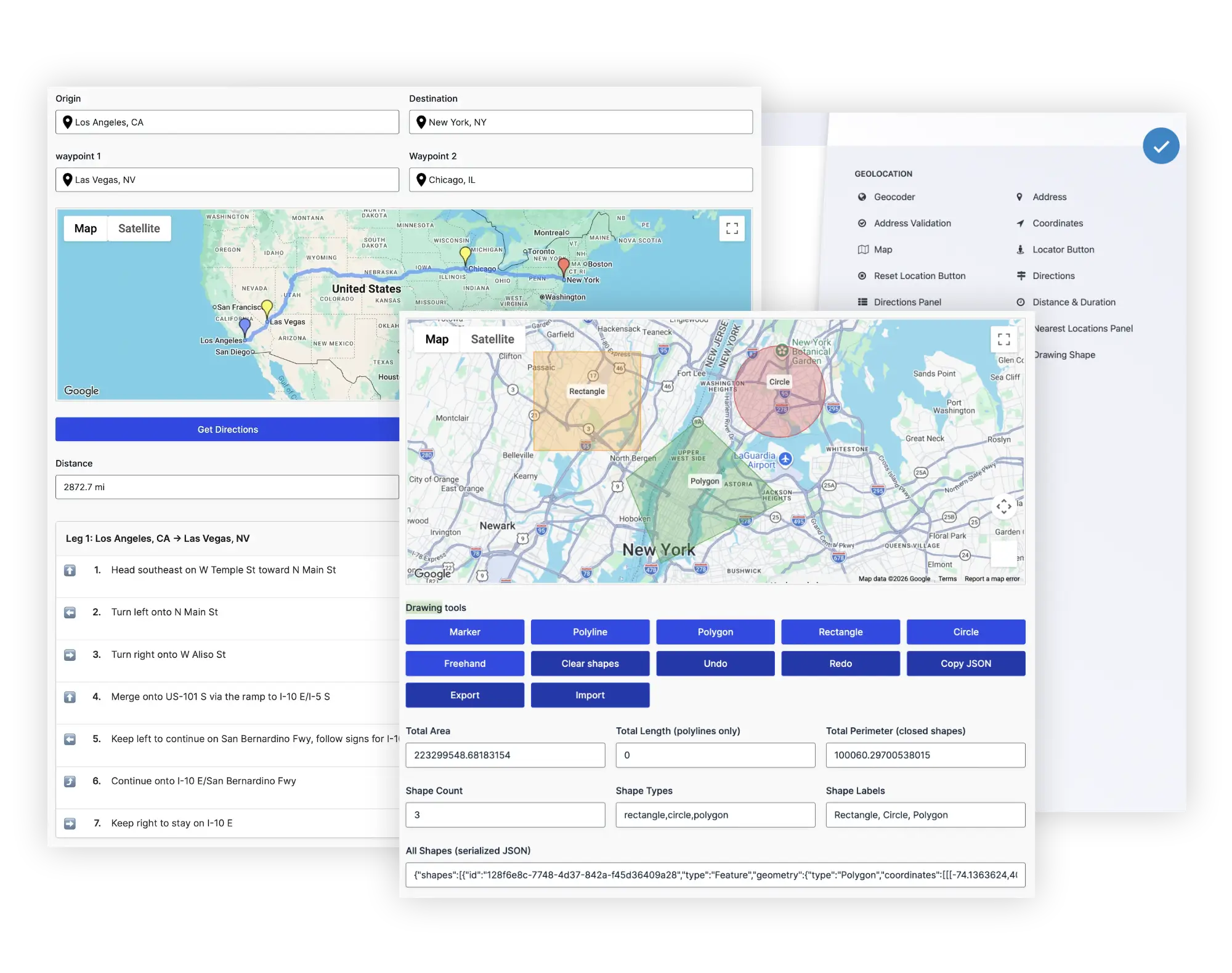
Everything You Can Build with Ninja Geolocation
Explore the complete geolocation toolkit that makes Ninja Forms location-aware, interactive, and workflow-driven.
Location Data Collection
Collect addresses, coordinates, maps, and user locations using native Ninja Forms fields.
Address Validation
Standardize addresses, identify potential issues, and improve data quality before submission.
Route & Distance Calculations
Calculate travel distance, duration, directions, and pricing directly inside your forms.
Interactive Maps
Display single locations, multiple submissions, or custom location data on interactive maps.
Nearest Location Search
Find the closest locations using driving distance, travel time, or radius searches.
Service Areas & Boundaries
Draw, edit, and store polygons, circles, and custom map shapes.
Native Ninja Forms Integration
Works with calculations, conditional logic, notifications, submissions, and third-party add-ons.
Location-Aware Workflows
Build dynamic forms that respond to user location, distance, and geolocation data.
Explore Ninja Geolocation Solutions
Discover how Ninja Geolocation helps you build smarter location-aware forms and workflows.
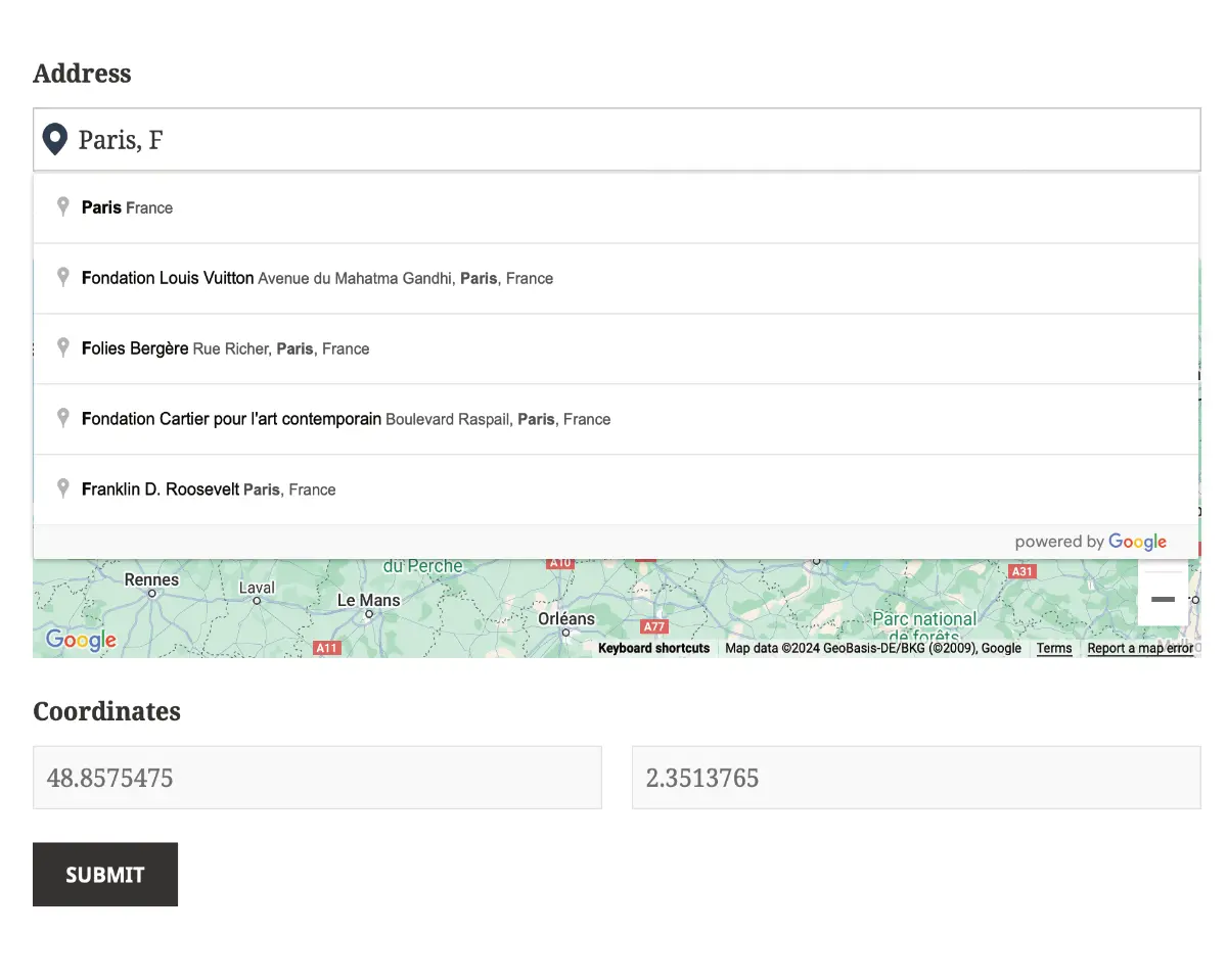
Geolocation Fields for Ninja Forms
- Address Field with Autocomplete for accurate address input.
- Coordinates Field for capturing latitude and longitude.
- Locator Button for quick user location detection.
- Map Field for visual location selection.
- Support for Multiple Location Groups within the same form.

Distance & Directions
- Travel Distance & Duration between one or multiple locations.
- Turn-by-Turn Directions displayed directly in your forms.
- Distance-Based Pricing for deliveries, quotes, and service fees.
- Multiple Waypoints & Travel Modes for advanced routing.
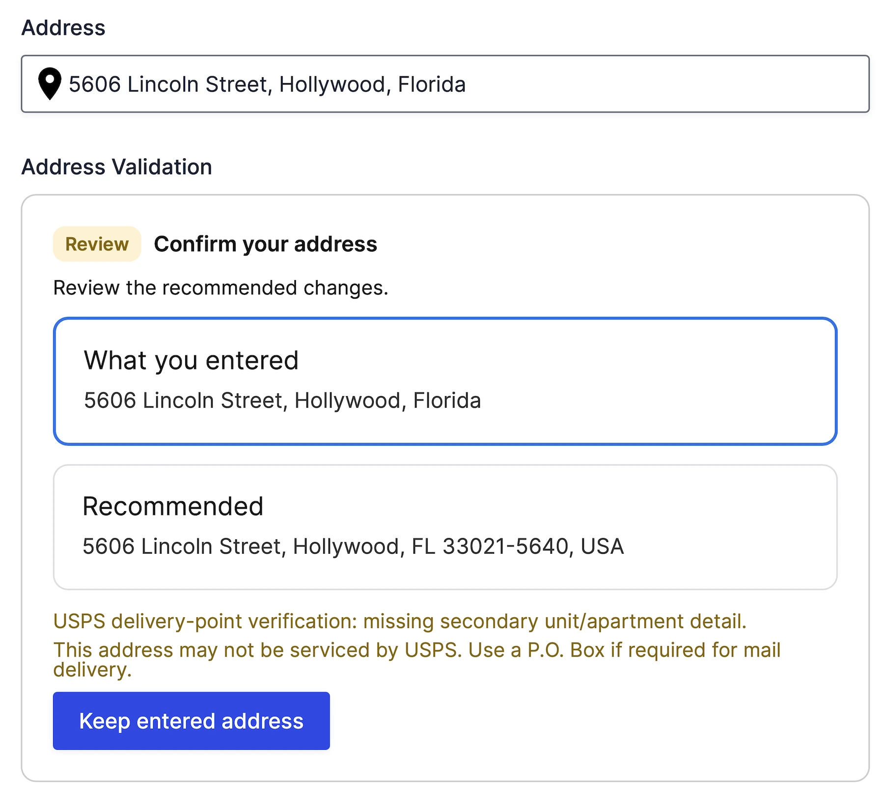
Address Validation
- Address Verification before users submit the form.
- USPS-related delivery-point signals for supported US addresses.
- Standardized Address Formatting for cleaner data.
- User Confirmation before accepting suggested corrections.
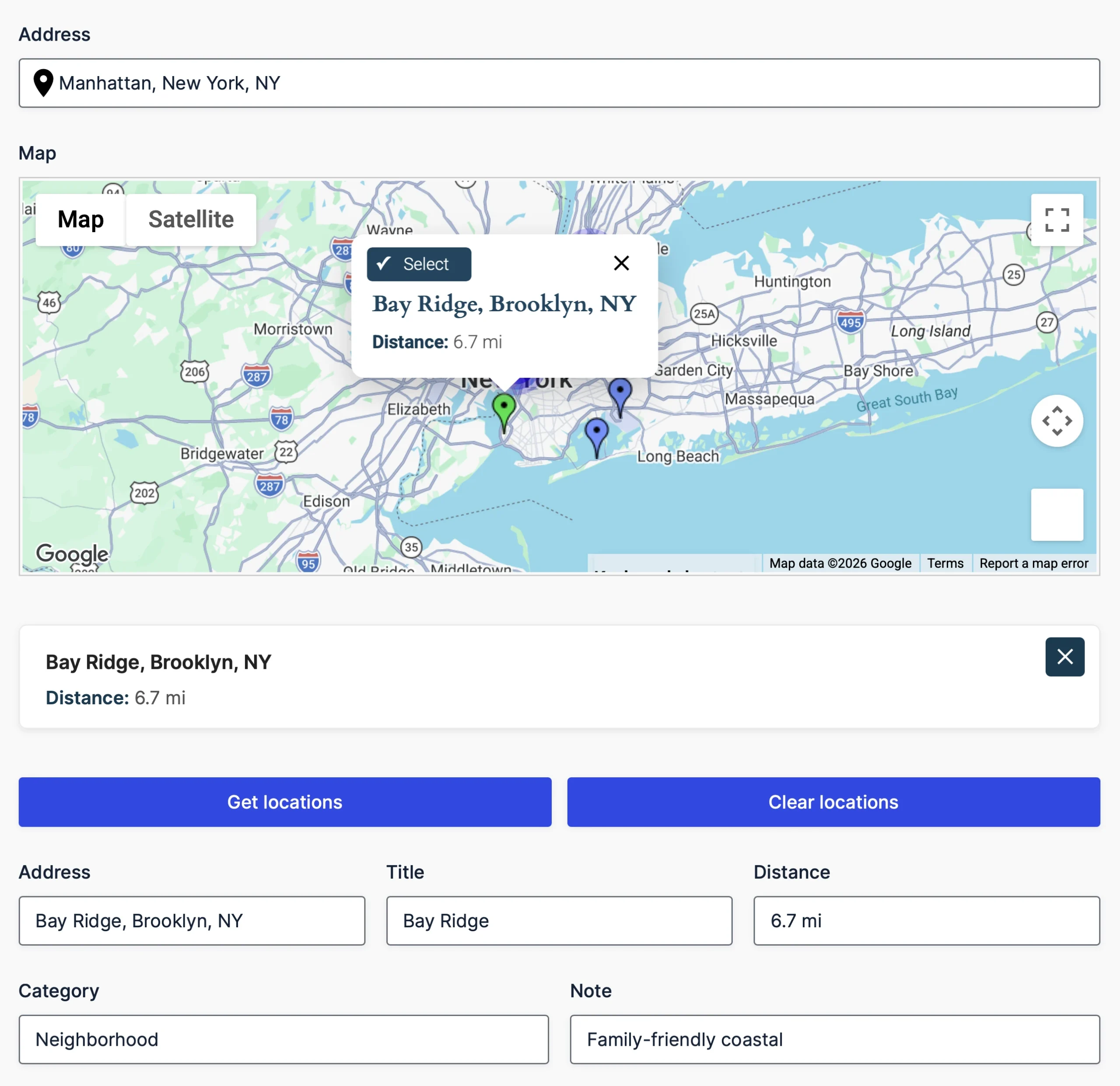
Nearest Locations
- Driving Distance & Radius Search for accurate matching.
- Location Data from Lists, CSV/JSON, or Databases.
- Interactive Map Selection with clickable markers.
- Dynamic Field Population for downstream workflows.

Drawing Tools & Shape Fields
- Markers, Polygons, Circles & Rectangles on Google Maps.
- Live Area, Length & Perimeter Calculations as users draw.
- GeoJSON Import & Export for custom map regions.
- Built-In Shape Editing & Management tools.
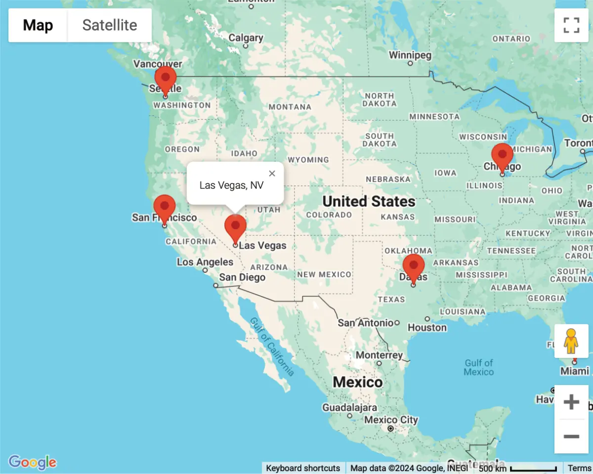
Interactive Maps
- Mashup Maps for displaying multiple submissions.
- Single Entry Maps for individual form entries.
- Marker Clustering for improved map performance.
- Custom Marker Icons & Map Styling to match your site.
Why Choose Ninja Geolocation for Ninja Forms?
Built on the WPGeo Framework for performance, reliability, and future growth.
Built with best coding practices, Ninja Geolocation is lightweight, secure, and optimized for fast performance, ensuring smooth geolocation features for any form.
Designed with a flexible structure, hooks, and filters, making it easy for developers to extend, modify, and integrate geolocation functionalities into any workflow.
We stay ahead of the curve with regular feature updates, performance improvements, and compatibility enhancements to keep your forms running smoothly.
Purchase with confidence. If it isn’t the right fit, request a refund within 14 days under our refund policy.
Get the most out of Ninja Geolocation with detailed guides, examples, and tutorials that simplify setup and customization.
Our dedicated support team is here to help—whether you have questions, need troubleshooting, or require customization guidance.
Test It Yourself – Explore the Interactive Demo
Choose Your Plan & Unlock Advanced Geolocation Features
Starter
Collect addresses and locations with ease
.00
/First year
- Address autocomplete with Google Places suggestions
- Interactive maps with draggable location markers
- Geocoding and structured address data
- Current-location detection and Locator Buttons
- Latitude and longitude fields
- Automatically populate connected location fields
- Reset Location controls
Pro
Turn locations into smarter form workflows
/First year
/First year
/First year
- Distance and travel-time calculations for form estimates
- Route maps and turn-by-turn directions
- Address validation with suggested corrections
- Nearby-location searches with selectable results
- Map drawing tools for shapes, areas, and boundaries
- Single-entry and multiple-entry maps outside your forms
Requires Ninja Forms. Google-powered features require your own Google Maps Platform API keys and enabled services. Any Google usage charges are separate.
Special introductory pricing applies to the first year. Renewals are billed at the regular price. You can upgrade or cancel your plan at any time. Each plan includes automatic updates, premium support, and is backed by our 14-day money-back guarantee.
All purchases are securely processed on GEO my WP, our parent platform, where you can manage your purchases, licenses, and subscriptions.