Google Map Field
Last modified: March 16, 2025
Using the Google map field, users can mark their location by dragging the marker on the map. This location will be then geocoded and produce the location data using the Geocoder field it is synced with.
Google Map Field Options
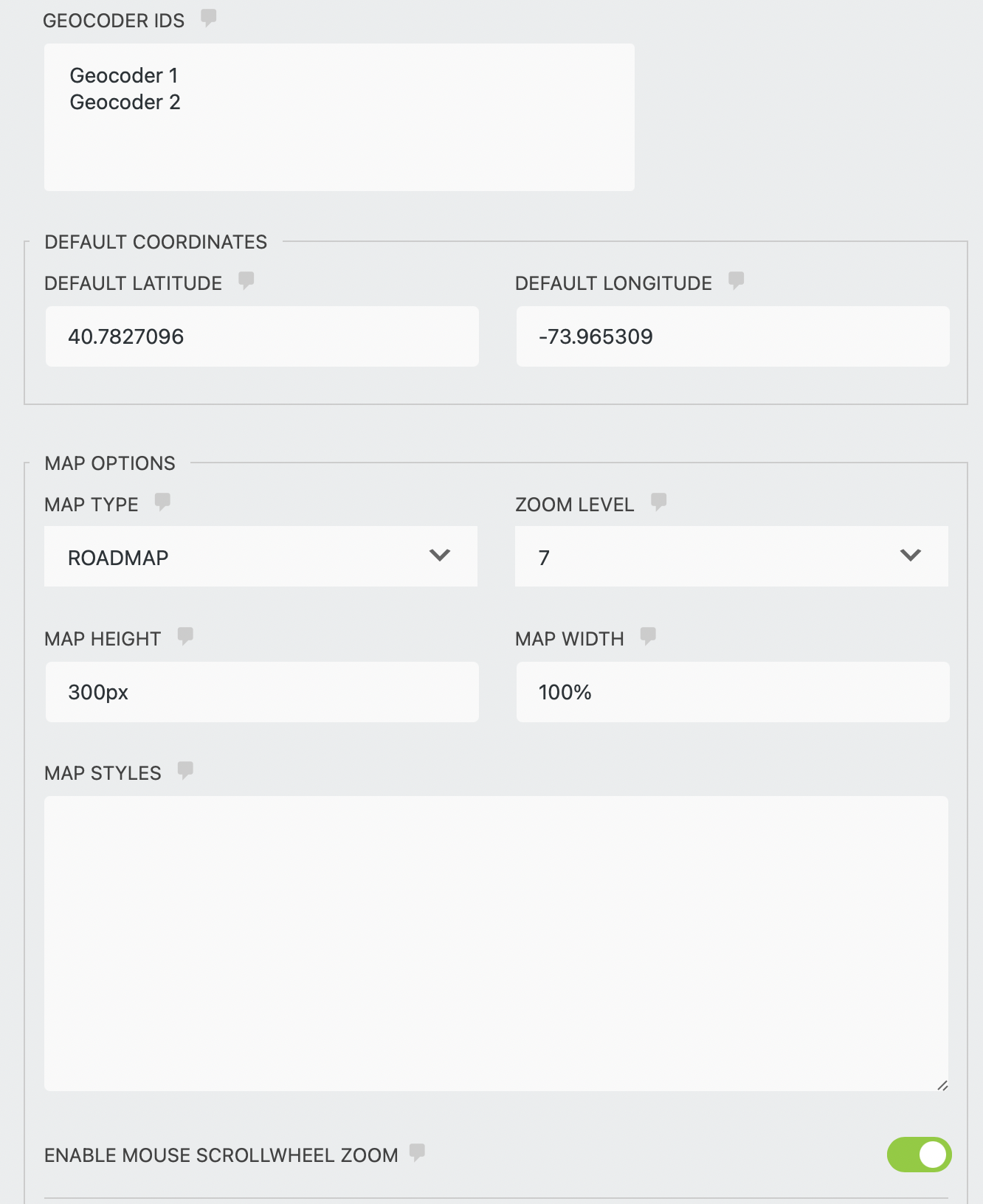
- Geocoder IDs - select a single or multiple geocoder fieldss which you would like to sync the map with.
- Default Latitude - enter the latitude of the position that will be used to center the map when the form first loads.
- Default Longitude - enter the longitude of the position that will be used to center the map when the form first loads.
Map Options
- Map Type - select between ROADMAP, SATELLITE, HYBRID, or TERRAIN.
- Zoom Level - Select the initial zoom level of the map.
- Map width - enter the map width in pixels or percentage. For example, 100% or 250px.
- Map height - enter the map height in pixels or percentages. For example, 100% or 250px.
- Map style - enter custom map style. Snazzy Maps website has a large collection of map styles that you can use.
- Enable Mouse scroll-wheel zoom - check this checkbox to enable map zoom using the mouse scroll wheel.
Map Bounds Restriction
Restrict the map view to a specific area by providing the Southwest and northeast points of this area.
- Southwest point - enter a set of coordinates, comma-separated ( ex. 26.423277,-82.1371324 ), that represents the southwest point of the area that you would like to restrict.
- Northeast point - enter a set of coordinates, comma-separated ( ex. 26.423277,-82.1371324 ), that represents the northeast point of the area that you would like to restrict.